
Severe Threat Today; East TN and Western NC LOOK OUT
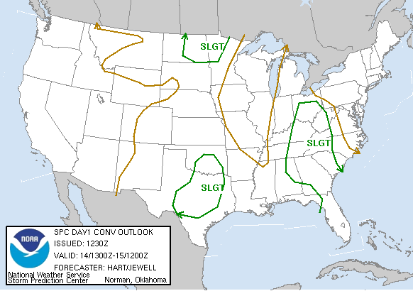
Yet again, the Storm Prediction Center has placed the entire area under a "slight risk of severe thunderstorms." Today's setup is very similar to Tuesday's. However, it appears that today's big winners could be East TN and Western NC.
The forecast models seem to be in agreement. Thunderstorms will develop across mountains and move southeast. With this setup, E TN and W NC will not miss out today.
Daytime heating will cause scattered to numerous showers and thunderstorms to develop this afternoon. High dew points will yield MLCAPE levels (Mean Layer Convective Available Potential Energy) of near 1000 J/KG.
Several storms should become strong, with some of those becoming severe. I wouldn't be surprised to see the SPC issue a watch around noon.
6/14/07-9:48 AM
![]()

No comments:
Post a Comment