

TONIGHT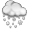 Snow & Sleet LO: 28°F Wind: E 5-10 Gusts: --- PoP: 90% | THURSDAY Wintry Mix to Rain HI: 36°F Wind: SE 5-10 Gusts: --- PoP: 80% | THU NIGHT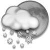 Sct'd Snow Showers LO: 28°F Wind: W 5 Gusts: --- PoP: 30% | FRIDAY AM Snow Showers HI: 42°F Wind: W 5 Gusts: --- PoP: 20% |
TONIGHT
Snow likely, especially after midnight. Snow may mix with or change to sleet at times, especially across Western NC. Freezing rain may also mix in at times. Lows in the upper 20s across Northeast TN; middle to upper 20s across Western NC. Wind from the east at 5-10 MPH. Chance of precipitation 90%. Snow accumulating 1-3"...with lower amounts in areas receiving periods of sleet or freezing rain. Ice accumulation generally less than .1".
THURSDAY
Snow and sleet likely in the early morning...slowly transitioning to freezing rain or rain. Precipitation becoming all rain by 10 AM across Northeast TN. Freezing rain and sleet possible across Western NC until noon...with a few rain showers possible in the afternoon. Highs in the middle to upper 30s across Northeast TN...and lower to middle 30s across Western NC. Wind from the southeast at 5-10 MPH. Chance of precipitation 80%. Snow accumulating 1-2"...with lower amounts in areas receiving periods of sleet or freezing rain. Ice accumulation generally less than .1" across Northeast TN...and from .1" to .2" across Western NC.
THURSDAY NIGHT
Flurries and a few snow showers possible...especially early. Lows in the upper 20s. Wind from the west at around 5 MPH. Chance of snow 30%. Little or no snow accumulation expected.
FRIDAY
Flurries and a few snow showers possible in the morning. Cloudy, with highs in the lower 40s. Wind from the west at around 5 MPH.

| TONIGHT Snow & Sleet LO: 24°F Wind: E 5-10 Gusts: --- PoP: 90% | THURSDAY Snow to Frz Rain/Rain HI: 34°F Wind: SE 5-10 Gusts: --- PoP: 80% | THU NIGHT Snow Showers LO: 23°F Wind: W 5-10 Gusts: --- PoP: 30% | FRIDAY AM Snow Showers HI: 38°F Wind: W 5-10 Gusts: --- PoP: 20% |
TONIGHT
Snow likely, especially after midnight. Sleet may mix in at times. Lows in the lower to middle 20s. Wind from the east at 5-10 MPH. Chance of precipitation 90%. Snow accumulating 2-4".
THURSDAY
Snow and sleet likely before noon. Rain or freezing rain mixing with the snow and sleet after noon...possibly becoming all rain before ending. Highs in the lower to middle 30s. Wind from the southeast at 5-10 MPH. Chance of precipitation 80%. Snow accumulating 1-3". Little or no ice accumulation expected...except across Northwestern NC, with .1" of ice possible.
THURSDAY NIGHT
A few snow showers possible, especially early. Lows in the lower to middle 20s. Wind from the west at 5-10 MPH. Chance of snow 30%. Little or no snow accumulation expected.
FRIDAY
Flurries and a few snow showers possible in the morning. Cloudy, with highs in the upper 40s. Wind from the west at 5-10 MPH.

SATURDAY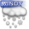 Snow & Windy HI: 32°F LO: 10°F PoP: 50% | SUNDAY AM Clouds PM Sun HI: 27°F LO: 11°F PoP: 20% | MONDAY Sunny & Cold HI: 31°F LO: 17°F PoP: 20% | TUESDAY Snow & Cold HI: 32°F LO: 19°F PoP: 50% |
Issued: 1/16/08 @ 11:27 PM EDT
![]()
