
Cold Front to Bring Relief Tomorrow...
...in more than one way.
A front draped across the Midwest will move in on Saturday, bringing much-needed rain, as well as cool down our temperatures for a few days.
Friday:
Ahead of the front, showers and thunderstorms will increase in coverage, with some of these storms becoming strong to severe. These storms could dump quite a bit of rain in a short amount of time.
Friday Night:
Thunderstorms will continue through the night. Don't expect much strong to severe activity overnight. However, the threat for heavy rain continues. I wouldn't be surprised to see some 1"/hr rates. (Though I don't expect those rates to last for an hour at a time)
Saturday:
The front will slow down after passing through the area, leaving the possibility for scattered thunderstorms through the day, and into the night as well.
This should be all over by Sunday.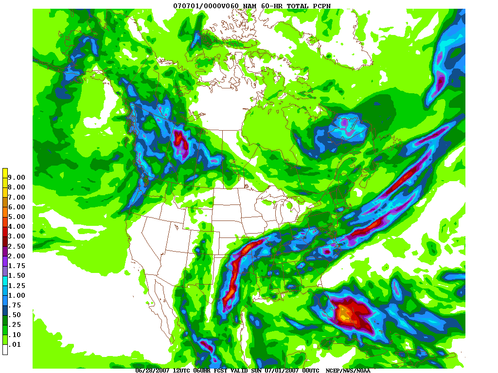
The NAM (above) suggests an area-wide total of .25"-.50", with some .75" totals. I believe this is low.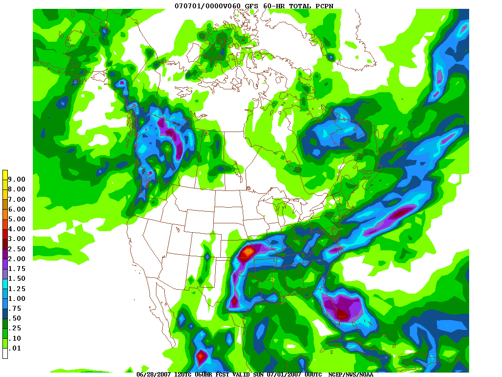
The GFS (above) seems to take this better. It suggests more along the lines of region wide .75"-1" totals.
Cooler temperatures will arrive Friday, and continue through the weekend. Temperatures will drop into the lower to middle 80's through the weekend, which is a welcome relief from this week's lower to middle 90's.
Partly cloudy skies will follow the front on Sunday. It looks to be a gorgeous day.
6/28/07-3:11 PM
![]()

No comments:
Post a Comment